Turisme Vall d'Àger

Itineraries on foot

Take a tour of the routes and itineraries of the valley and discover all its beauty.

Routes

This map shows the routes that can be walked on, by BTT or even some horse- riding.  In the accordions below you will find a brief description about these routes,  as well as the gradients and the number of kilometers of each route.

https://www.ager.cat/descobreix/itineraris-i-rutes-1

Impressive route, of great geological and ecological value, through the gorge of the Noguera Ribagorçana that cuts the rock separating Aragon and Catalonia. We will walk through an impressive geology of huge cliffs. The whole route is a series of geological strata settled from the beginning from the Secondary or Mesozoic era to the Quaternary. It can be done on foot from Corçà, or you can drive to the Pertusa hermitage and the rest must be done on foot.

Distance: 8,3 km

The route begins with a first section of ascent between Mediterranean vegetation and the views of the town of Corçà. In the Pardina ravine we can appreciate the flora of the shady areas. We will end up at the castle of Sant Llorenç, ruins of the 11th century fortified enclosure, and the remains of the old town; here we will enjoy a splendid panorama of the Seguer Gorge and the whole valley. This route can be done on foot or on horseback.

Distance: 4 km

Medium-sized path to the last section of steep ascent to the tower, which will reward us with a fascinating panorama of the gorge of Fet. The 13th century Conclus Tower belongs to the district of St. Llorenç and emerged as a strategic enclave to control the banks of the river Noguera Ribagorçana in the strait of Fet. The tower is also called the Tinyoses tower by the locals, as it was the place where the flock affected by the ringworm was isolated. This route can only be done on foot.

Distance: 5,3 km

Old rural road, pleasant and with beautiful views, which connects both villages and runs between Mediterranean forest and crops. Near Sant Pere Màrtir is an outcrop of sedimentary sandstones from river currents of the Lower Eocene, 60 million years ago. It can be done on foot, on horseback or by mountain bike.

Distance: 8,5 km

Long route that reaches the highest point of Montsec at 1676 m. Spectacular views on both sides of the mountain range. On Castellet Hill we will see the overlapping front over the valley: Upper Triassic materials from 200 million years ago, overlapping those from the Eocene 60 million years ago. It can be done on foot, on horseback, by mountain bike and by car to the port of Ares, where the free flight take-off area is located. It is recommended to do the route on foot from the Coll d’Ares to Sant Alís.

Distance: 17 km

Long-distance route along the first step of the Montsec. We will enjoy a magnificent panorama of the valley and a spectacular landscape of Mediterranean forest of holm oaks and pine trees passing by the hermitage of Pedra of the 11th and 16th centuries and the sanctuary-refuge of Colobor from the 16th century. The route can be done on foot, or by car, horse and mountain bike to Pedra or on horseback and mountain bike by the Àger-Pedra-camí dels Petrolers-Àger variant.

Distance: 11 km

A journey between forests and crops. In the Contorna ravine, we will see the gray sediments of the lower Eocene river networks, 50 million years ago. We will pass in front of the sanctuary of St. Llobí from the 13th century, ending the route in an extensive plan of rudder and holm oaks that owes its name to the celebration of covens in antiquity. Good views all along the route. A route that can be done on foot, on horseback and by mountain bike, also by car from Agulló to St. Llobí and the rest on foot.

Distance: 8,5 km

Road between crops and forests of oak and holm oak in the Serra del Montclús, under the remains of a Roman road that led to Lleida in ancient times. We will finish in the church and Romanesque towers of Cas from the 11th-12th centuries. It can be done on foot and on horseback, also by car and mountain bike from Port d’Àger to Cas.

Distance: 7,5 km

Smooth and pleasant short walk. It begins and ends by crossing the riparian forests of the Fred River. It runs between oak groves in the shade of the Serra del Montclús and the south face of the village of Àger, with panoramic views of the town. Crossing the first stretch of the river are the remains of a flour mill from the medieval period. This route can be done on foot, on horseback and by mountain bike.

Distance: 2,3 km

Simple and quiet walk that connects both villages following the course of the river Fred to the east. We will walk through beautiful riverside and oak forests. The route ends in front of a unique geological point: the outcrop of paleodunes formed by the tidal currents of the early Tertiary or Cenozoic era. It can be done on foot, on horseback or by mountain bike.

Distance: 4,5 km

Itineraries


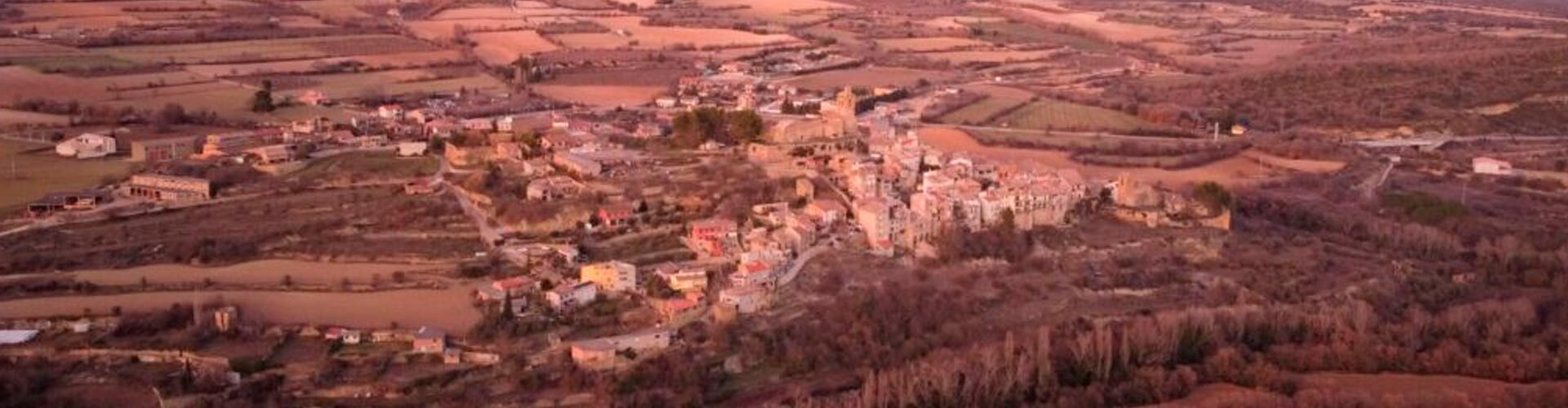
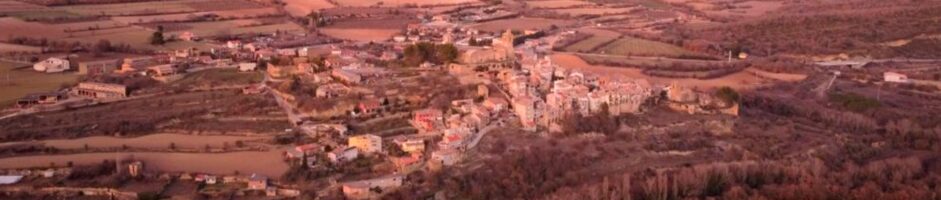
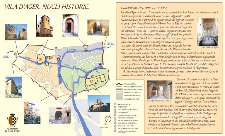
Here, you will find a tour of the historic center of the town. More information about the historic center and booking guided tours at this link.


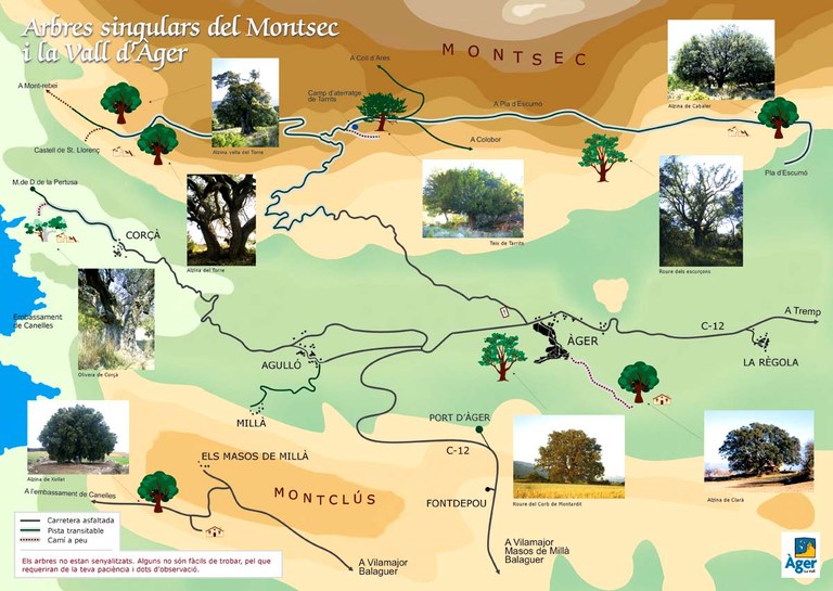
In this itinerary you will be able to see very special trees . Some of them are hard to find, because are not well indicated. 


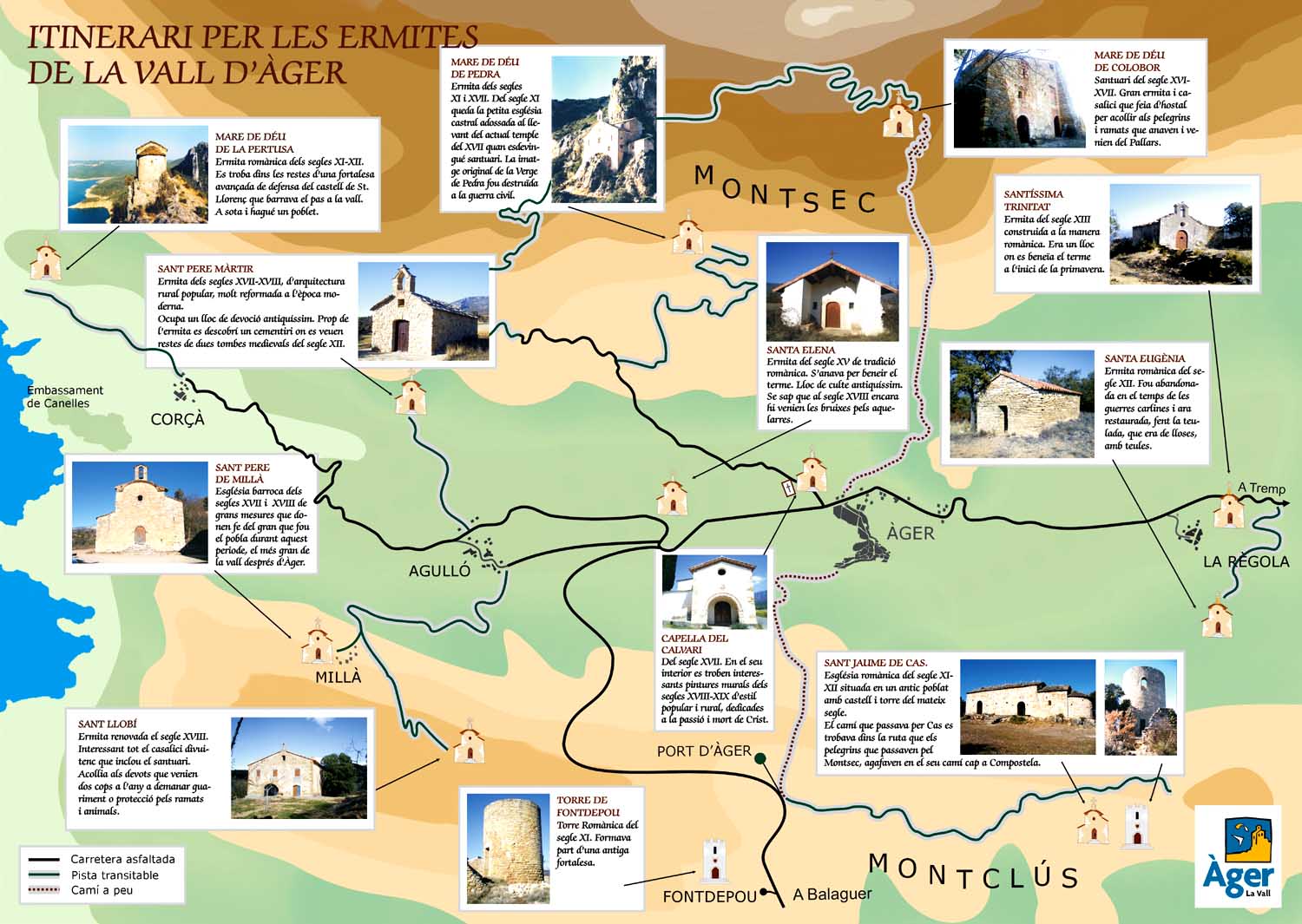
A tour of the hermitages in the valley. You can expand the information of the visatable sites at this link.

You may also be interested in

Flight
History and culture are present in all spaces forming a monumental ensemble throughout the Valley.
Kayak

Discovering the Congost de Montrebei from the water is one of the greatest privileges offered by our environment.

Climbing and routes
For lovers of heights, steep paths and challenges you have great options for climbing routes.